Former head of the Cadastre Committee Sarhat Petrosyan writes on his Facebook page:
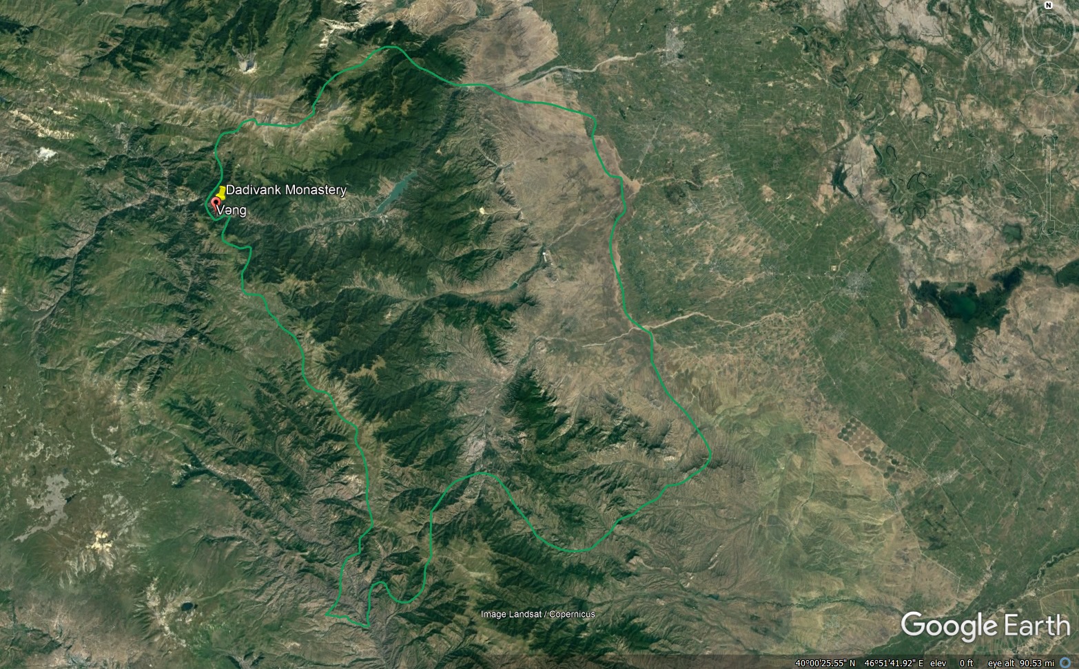
“So we did a very simple thing. We put the map published by the General Staff of the Russian Federation on Google Maps (link to the map in the comments).
It turns out that Dadivank and Tigranakert remain in the territory of the Armenian (or Russian) forces. In the case when people do not seem to discuss for 2-3 days, I do not say how many people called and said “let’s go and bring the khachkars”.
Of course, what we did is not accurate and needs another professional and accurate installation. Let the appropriate and capable people and bodies respond. We will correct if there are more precise data.
Was there not a single person in the state bodies that printed various beautiful information things and logos to say or do such a thing? Of course, demarcation is first of all the work of the cadastre, but since it has turned into a “proactive sizing laundry”, we have no empty expectations.
Now, the next problem: Amaras is 5 km out of our territory. Therefore, in case of normal negotiations in the next few days, it is possible to try (perhaps by conceding another equivalent area) to bring back the 4th century Amaras.
Is the capitulated government ready for such negotiations? In my opinion, no. I wish I was wrong…”